 R-2615 - U.S. 421 / U.S. 321 - Improvements - Watauga County
R-2615 - U.S. 421 / U.S. 321 - Improvements - Watauga County
Proposal to improve U.S. 421/ U.S. 321 from U.S. 321 to N.C. 105 Bypass near in Watauga County
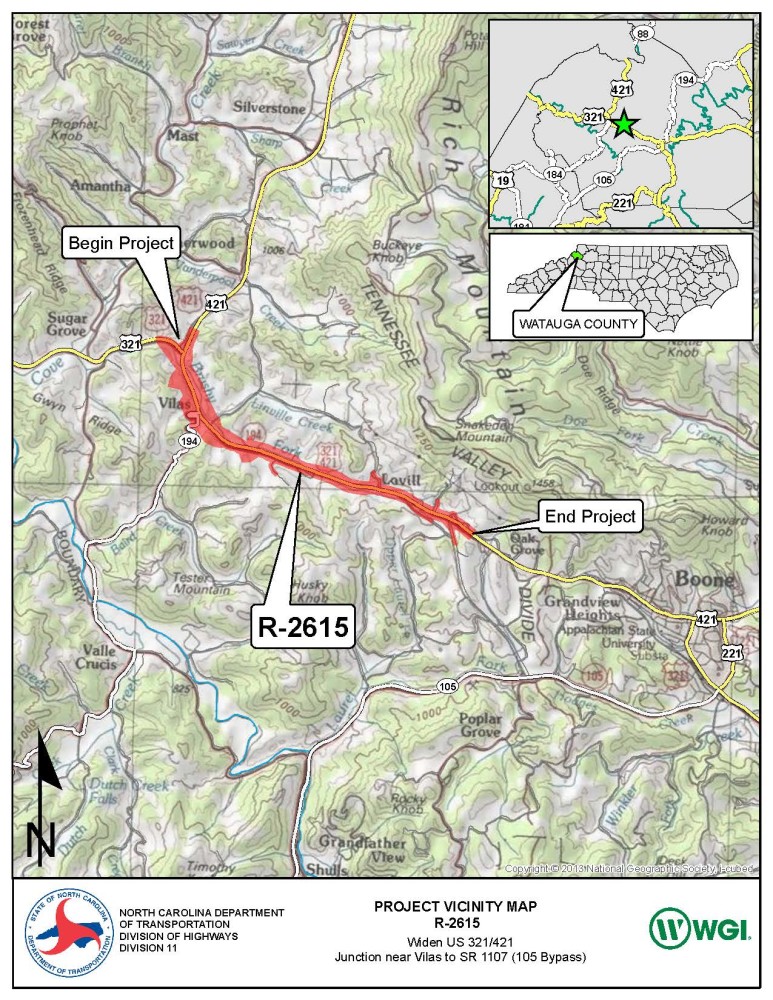
Vicinity Map:
Open House Public Meeting
_____________________________________________
Oct. 13, 2022
Brushy Fork Baptist Church
3915 U.S. 421 North,Vilas
4:00 pm to 7:00 pm
There will be no formal presentation
Project Overview
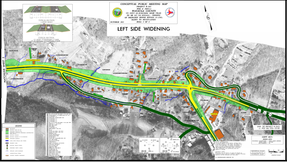
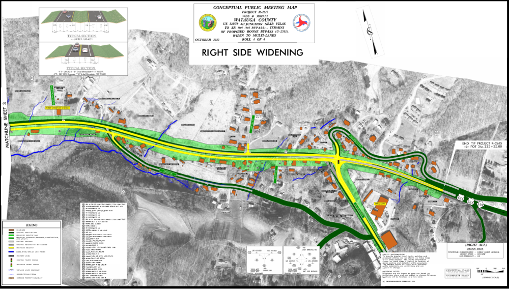
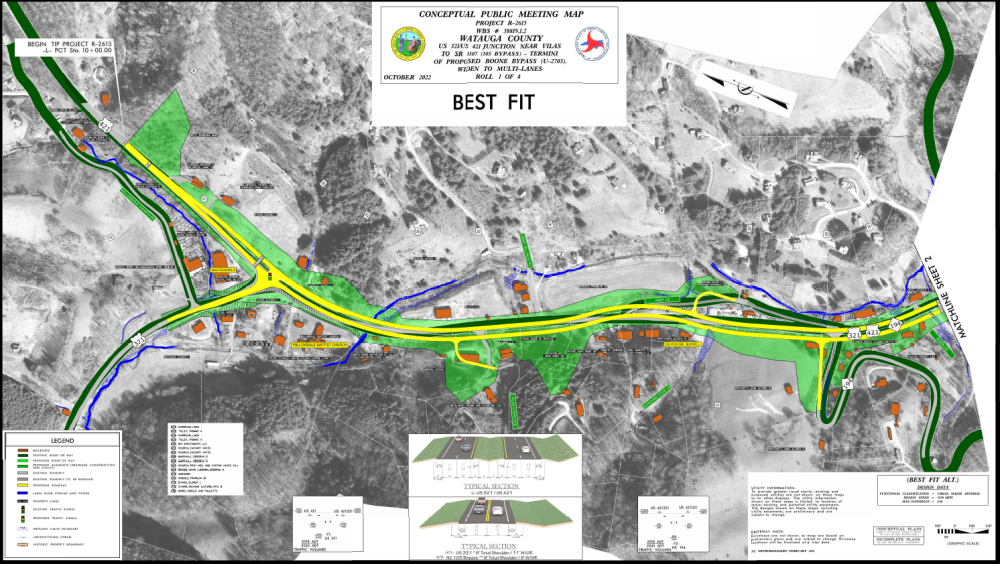
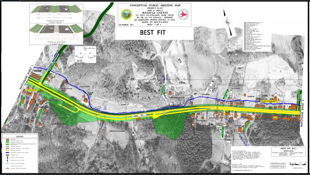
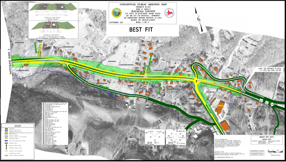
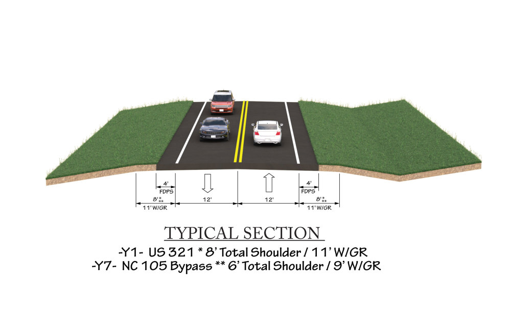
The N.C. Department of Transportation proposes improvements to U.S. 421 / U.S. 321 from U.S. 321 to N.C. 105 Bypass near Old Bristol Road in Watauga County.
The purpose of the project is to improve traffic flow, mobility, and safety for all transportation users along the corridor.
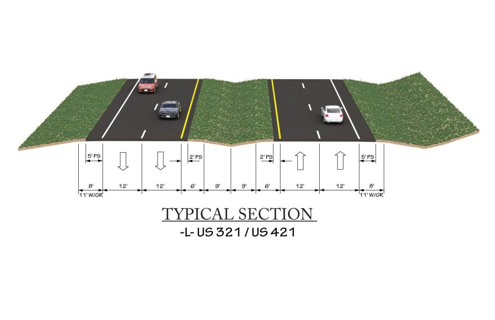
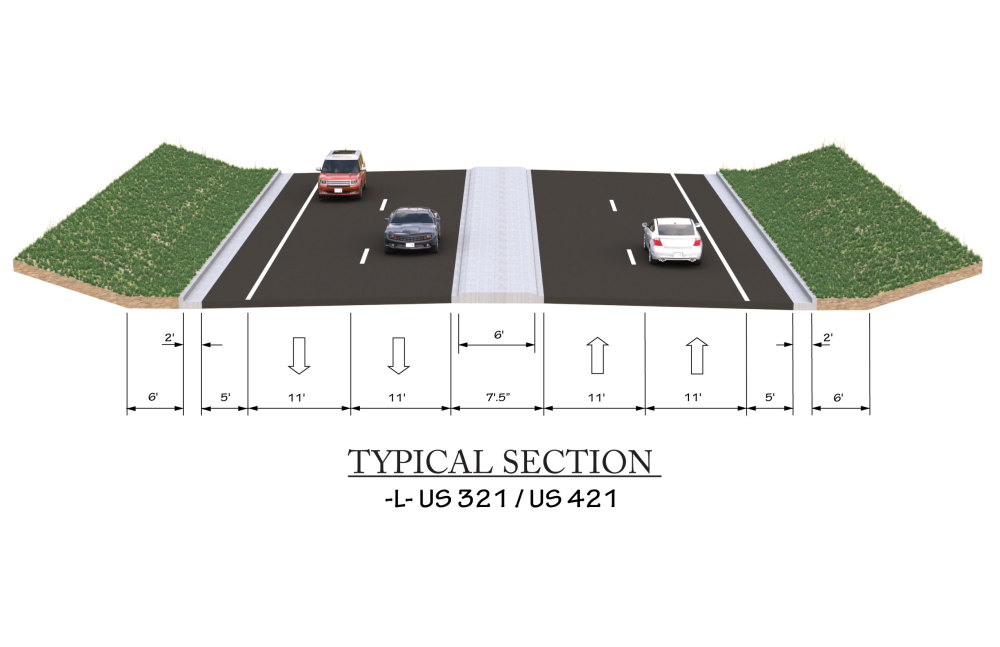
The project proposes to widen the road from a single lane to two lanes in each direction separated by a 30-foot median with 5-foot paved outside shoulders.
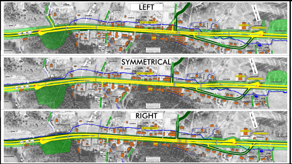
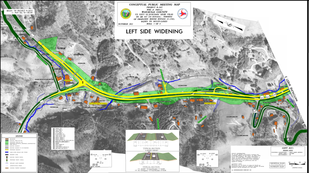
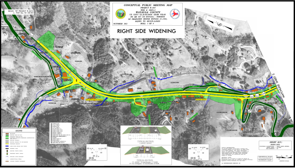
- The recommended alternative is a Best Fit alternative that widens either to the left or right side of the current road alignment to avoid or minimize impacts to resources.
- The project team is seeking public input about widening through the community of Vilas.
Responses to questions received during comment period
Project Maps
Click on the links or the thumbnails below to view or download the maps.
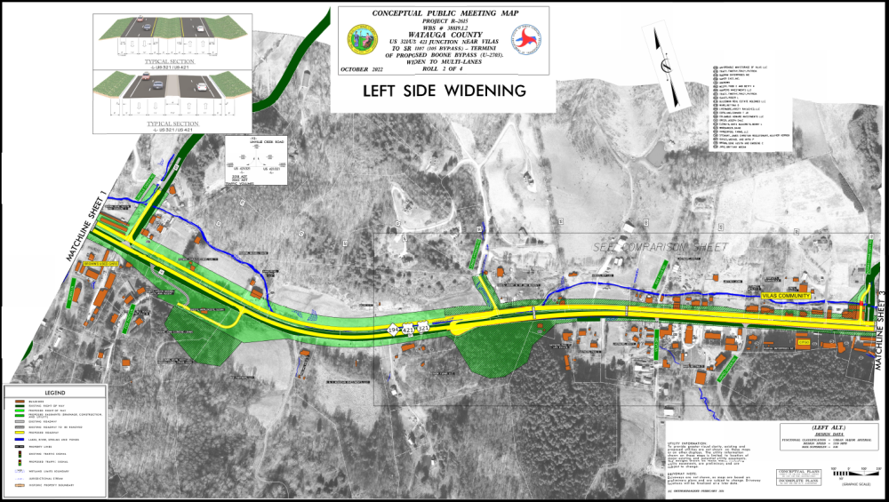
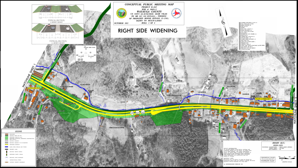
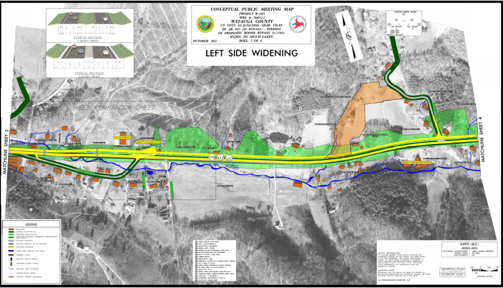
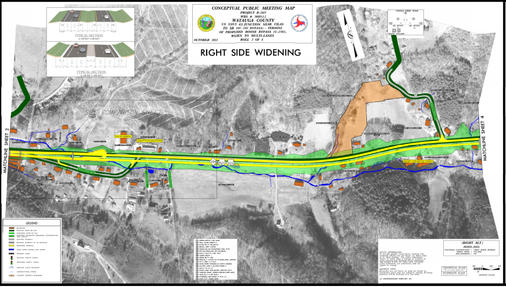
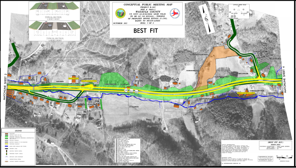
West and East of Vilas
Through Vilas
Adjacent Roadways
Reduce conflict Intersections (RCIs) informational video
Project Funding:
Activity | Funded costs Costs* |
| Utilities | $ 1.5 Million |
Right-of-Way Acquisition | $ 40.9 Million |
Construction Cost | $ 50.2 Million |
Total Cost | $ 92.6 Million |
*Funded costs are subject to change.
Project Timeline:
Milestone | Date* |
Public Meeting | October 13 2022 |
Environmental Document | Spring 2025 |
Right-of-Way Acquisition Begins | Fall 2026 |
Construction Begins | Summer 2030 |
* Future dates subject to change.
Comments:
NCDOT accepts comments throughout all planning, design, and construction phases of project development.
All comments will be taken into consideration, and carry equal weight, regardless of submittal method.
Comments for consideration during the current phase of project development were submitted by October 27, 2022.
PROJECT CONTACT INFORMATION
Wesley Cartner
Project Manager for Divisions 11-14
NCDOT Project Management Unit
1582 Mail Service Center
Raleigh, NC 27699-1582
PROJECT CONTACT INFORMATION
Martha Register
Consultant Project Manager
WGI
5640 Dillard Drive
Cary, NC 27518
Title VI Feedback
To ensure we’re hearing from a broad set of voices, would you be willing to share (completely anonymously) some information about yourself?
If so, please click here https://publicinput.com/NCDOT-Title-VI
RESOURCES FOR PROPERTY OWNERS
Although the N.C. Department of Transportation works to minimize the number of homes and businesses displaced by a road project, it is inevitable, in many cases, that a certain amount of private property is needed. The following information explains right of way acquisition and answers questions about the process.
Right-of-Way Brochure Single Page Layout Folleto del Proceso de Adquisición de Bienes Raíces
Right-of-Way Frequently Asked Questions
Right of way Acquisition Process Videos
Page Last Updated- March 5 2026