 U-5720: U.S. 70 Durham
U-5720: U.S. 70 Durham
This page is intended as a survey site to collect comments on this project.
For the latest information on this project, please visit: https://www.ncdot.gov/projects/us-70-durham/Pages/default.aspx
Work on this project is currently suspended.
Vicinity Map:
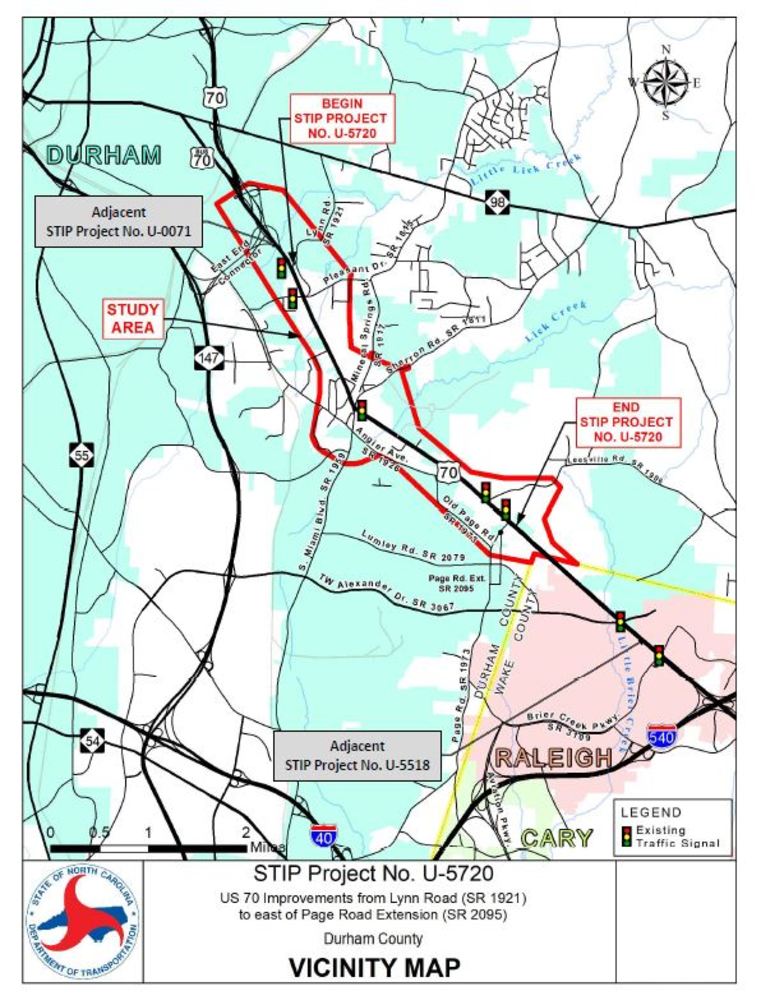

OVERVIEW
U.S. 70 between Lynn Road and Page Road Extension experiences traffic congestion, poor operating conditions, and a higher than average number of vehicle crashes. The purpose of this project is to improve traffic operations and reduce conflicting vehicular movements on U.S. 70 and associated intersections in the project corridor.
Conceptual Corridors
At the public meetings on October 30 and November 1, 2018, concepts for the main roadway (U.S. 70) and options being considered and examined for intersections along the corridor were provided for public review and comment.
The study area shown is a broad survey area and is not intended to reflect any level of potential impacts. Direct impacts from the proposed project will be contained within the study area, but not all properties within the study area will be impacted
Three Widening Concepts (north, south and upgrade existing) were considered for the improvement of U.S. 70. In the northern and southern widening concepts, a portion of the existing U.S. 70 would be retained as a service road providing access to adjacent land uses.
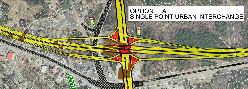
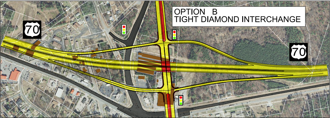
In addition, NCDOT is presented two design options for the proposed Sherron Road/South Miami Boulevard interchange: Option A - a Single Point Urban Interchange (SPUI) or Option B - a Tight Diamond Interchange. Graphic depictions of these and the roadway concepts are shown below.
For Additional information on this project, please visit: https://www.ncdot.gov/projects/us-70-durham
Sherron Road/South Miami Boulevard - Interchange Options
Option A: Single Point Urban Interchange (SPUI)
Option B: Tight Diamond Interchange
Public Involvement
Public Meetings
Two Public Meetings were held on October 30 and November 1, 2018 to gather feedback on conceptual designs.
Public Meeting Maps:
PROJECT CONTACT INFORMATION
Sara Sherman, P.E.
NCDOT Project Management Unit
1582 Mail Service Center
Raleigh, NC 27699-1582
Project Email: US-70-Durham@publicinput.com
Project Phone: 984-205-6615 Code: 3394
RESOURCES FOR PROPERTY OWNERS
Although the N.C. Department of Transportation works to minimize the number of homes and businesses displaced by a road project, it is inevitable, in many cases, that a certain amount of private property is needed. The following information explains right of way acquisition and answers questions about the process.
Right-of-Way Brochure Single Page Layout Folleto del Proceso de Adquisición de Bienes Raíces
Right-of-Way Frequently Asked Questions
Right of way Acquisition Process Videos